
 Print
Print Description
Original colour lithographs. on paper.
Size in cm: The overall size is ca. 24.5 x 31 cm. The image size is ca. 21 x 26.5 cm. Size in inch: The overall size is ca. 9.6 x 12.2 inch. The image size is ca. 8.3 x 10.4 inch.
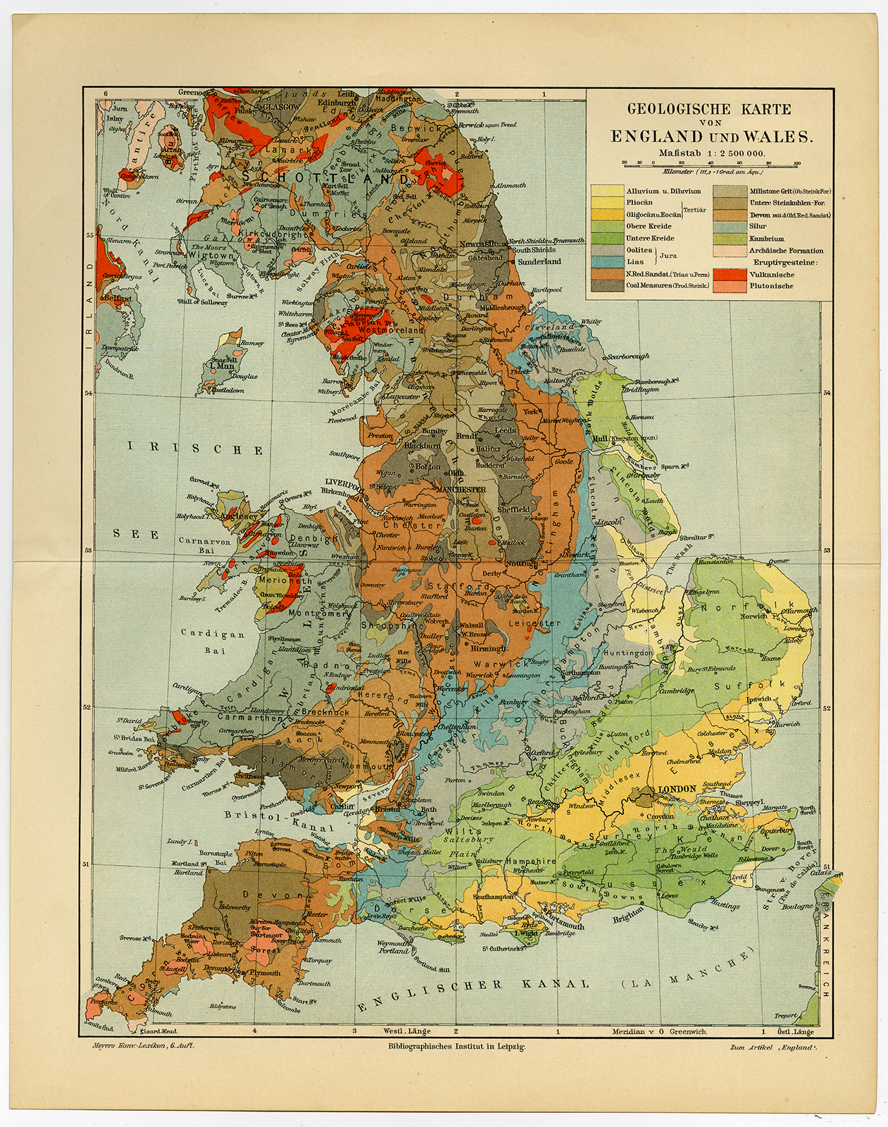
Map: ‘Geologische Karte von England und Wales’. (Geological map of England and Wales). This attractive original map originates from the 6th. edition of Meyers’ Konversationslexikon. This famous encyclopedia was published 1902-1920. The prints were used for several similar publications, such as the Brockhaus encyclopedia, and the similar Dutch encyclopedias by Oosthoek and Winkler Prins.Artists and Engravers: The original founder and publisher who initiated this famous enxyclopedia was Joseph Meyer (1796-1856, Hildburghausen, Germany).
Condition: Excellent, given age. Original middle fold, as issued. General age-related toning. Please study scan carefully.
Keywords: ANTIQUE MAP-GEOLOGY-ENGLAND-WALES-MEYERS
(PCOMAN) A167-11

Reviews
There are no reviews yet.