Antique Map-FRANCE-PERIGUEUX-CAMP DE CESAR0ARCHAEOLOGY-Caylus-1767

Print

€125.00

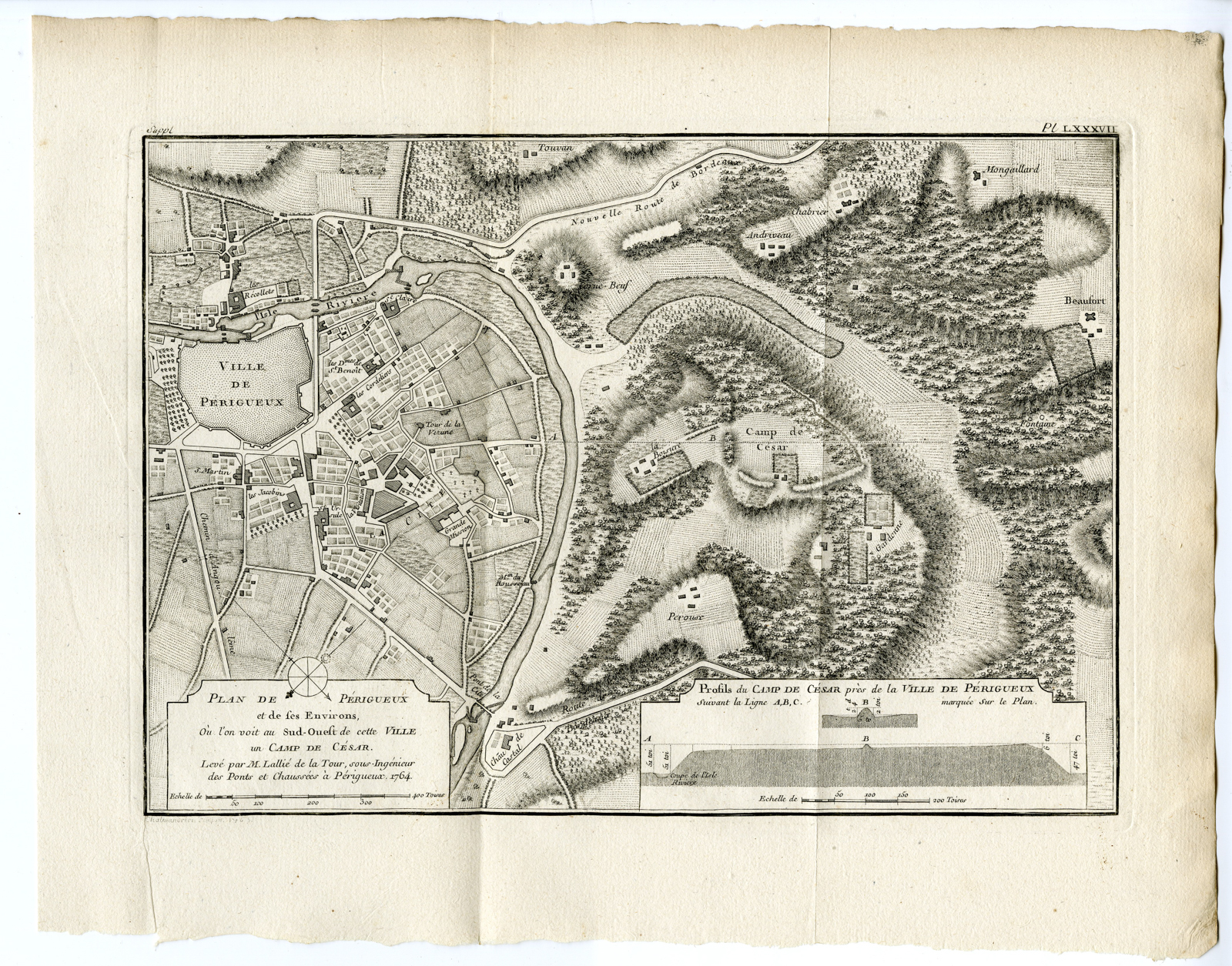
‘PL. LXXXVII. PLAN DE PERIGUEUX ET DE SES ENVIRONS (..).’

– Original antique print showing a plan featuring a detailed urban view of Perigueux to the left, a comprehensive landscape overview layout of the fortified Caesar’s Camp heights to the right, and a horizontal cross-sectional profile view (Profils du Camp de Cesar…) measuring terrain elevations at the lower right corner. Despite its colloquial Roman name, archaeological excavations confirm it was a fortified Iron Age oppidum established by the native Petrocorii Celtic tribes before the Roman expansion.

In stock

SKU: PCOM-1419 Categories: , Tag:

Description

Medium: Engraving/etching on hand laid (verge) paper.

Sheet size: 34 x 27 cm (13.39 x 10.63 inch). Image size: 28 x 20 cm. (11.02 x 7.87 inch).

Condition: very good, given age. Original folds as issued. General age-related toning and/or occasional minor defects from handling. Please study scan carefully.

FRANCE-PERIGUEUX-CAMP DE CESAR0ARCHAEOLOGY | PCO-MISC-BOX-02

BACKGROUND INFORMATION

From: ‘Receuil d’Antiquités Egyptiennes, Etrusques, Grecques, Romaines et Gauloises. Supplement, Tome Septieme. By Anne-Claude-Philippe de Chubieres & Comte de Caylus. Published by N.M. Tilliard, Paris, 1767.

Biography engraver: Engraver unknown/to be determined.

Biography artist: Compte de Caylus (1692-1765) was a French antiquarian and archaeologist.
Additional information

Dimensions 27 × 34 × 1 cm

Reviews

There are no reviews yet.

Be the first to review “Antique Map-FRANCE-PERIGUEUX-CAMP DE CESAR0ARCHAEOLOGY-Caylus-1767”

You might also like: