
 Print
Print Description
2 Tone colour lithograph with hand coloured border lines. on paper.
Size in cm: The overall size is ca. 37 x 29.5 cm. The image size is ca. 33 x 25 cm. Size in inch: The overall size is ca. 14.6 x 11.6 inch. The image size is ca. 13 x 9.8 inch.
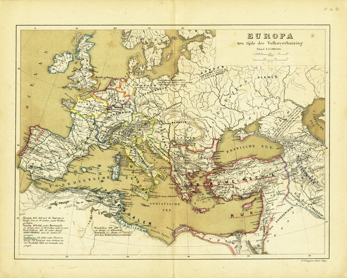
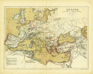
Map : ‘ Europa ten tijde der Volksverhuizing.’ (Europa at the time of the Migration Period). This original antique map originates from: ‘Historisch-Geographische Atlas der Algemeene en Vaderlandsche Geschiedenis’ (Historic Geographic Atlas of the general and Dutch history) by W. Huberts, published in Zwolle, The Netherlands in 1877.Artists and Engravers: W. Huberts, author. W. B. Kuijpers, lithographer.
Condition: Fine. General age related toning and soiling. Slightly foxed mainly in the margins, not effecting image. A few small tears in the margins and middle fold, backed. Please study scan carefully.
Keywords: ANTIQUE MAP-EUROPE-MIGRATION PERIOD-BARBARIAN INVASIONS-HUBERTS
(PCO) A223-06
![Scotland [After LACROIX, SANSON, Halma ed., 1705]](https://pictura-prints.com/wp-content/uploads/2018/12/pco-2716-e1545044718244-324x439.jpg)

Reviews
There are no reviews yet.