

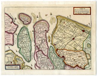
Description
Medium: Engraving/etching with original old hand colouring on hand laid (verge) paper.
Sheet size: 25.2 x 19.6 cm (9.92 x 7.72 inch). Image size: 22.8 x 16.6 cm. (8.98 x 6.54 inch).
Condition: good, given age. Small tears left edge, repaired. General age-related toning and/or occasional minor defects from handling. Please study scan carefully.
DELFLAND-SCHIELAND-VOORNE-GOEREE-ZEELAND-NETHERLANDS | PCOA55-27
BACKGROUND INFORMATION
Published in Atlas Portatif by Daniel de la Feuille in The Netherlands c. 1700.
Biography artist: Daniel de La Feuille (1640-1709), Dutch publisher and printmaker.

Reviews
There are no reviews yet.