
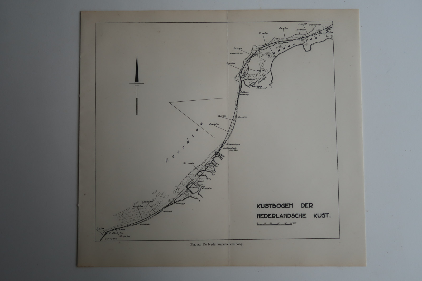
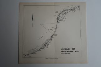
Description
Map showing the coastal sand arches, Netherlands in 1937.
Made by an anonymous engraver after Aardr. Genootschap.
Medium: Lithograph on wove (vellin) paper.
Image size: 23 x 21 cm. (9.06 x 8.27 inch).
Condition: good, given age. Original fold as issued. General age-related toning and/or occasional minor defects from handling. Please study scan carefully.
COAST-THE NETHERLANDS-SAND ARCHES | PCO-B5-27
BACKGROUND INFORMATION
Source: ‘Tijdschrift van het Koninklijk Nederlandsch Aardrijkskundig Genootschap’, a periodical published from 1888-1966, initially published by C.F. Stemler and later by Brinkman/Beijers (from 1879) and Brill (from 1891). This item dates from 1937.
![ENGLAND-KING CHARLES II-PORTRAIT [After RUSSELL, 1780]](https://pictura-prints.com/wp-content/uploads/2019/04/pcom-10114-324x531.jpg)


Reviews
There are no reviews yet.