

Description
Lithograph. on paper.
Size in cm: The overall size is ca. 68 x 54 cm. The image size is ca. 60.5 x 46.5 cm. Size in inch: The overall size is ca. 26.8 x 21.3 inch. The image size is ca. 23.8 x 18.3 inch.
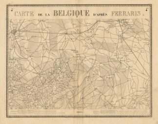
Map : ‘Carte de la Belgique d’ apres Ferraris’ (Map of Belgium and The Netherlands.) Lithographic map after J. Ferraris of a part of The Netherlands and Belgium. Breda and tilburg can be seen. At the bottom is a scale. Published in Brussels ca. 1850 by Etablissement Geographique de Bruxelles.Artists and Engravers: By Philippe Vandermaelen (1795-1869). Joseph Jean François, count de Ferraris (Luneville, April 20, 1726 – Vienna, April 1, 1814) was an Austrian general and cartographer.
Condition: Excellent. general age related toning. some light staining from handling.
Keywords: ANTIQUE MAP-BRABANT-LIMBURG-VANDERMAELEN
XXX-B4-18

Reviews
There are no reviews yet.