
Description
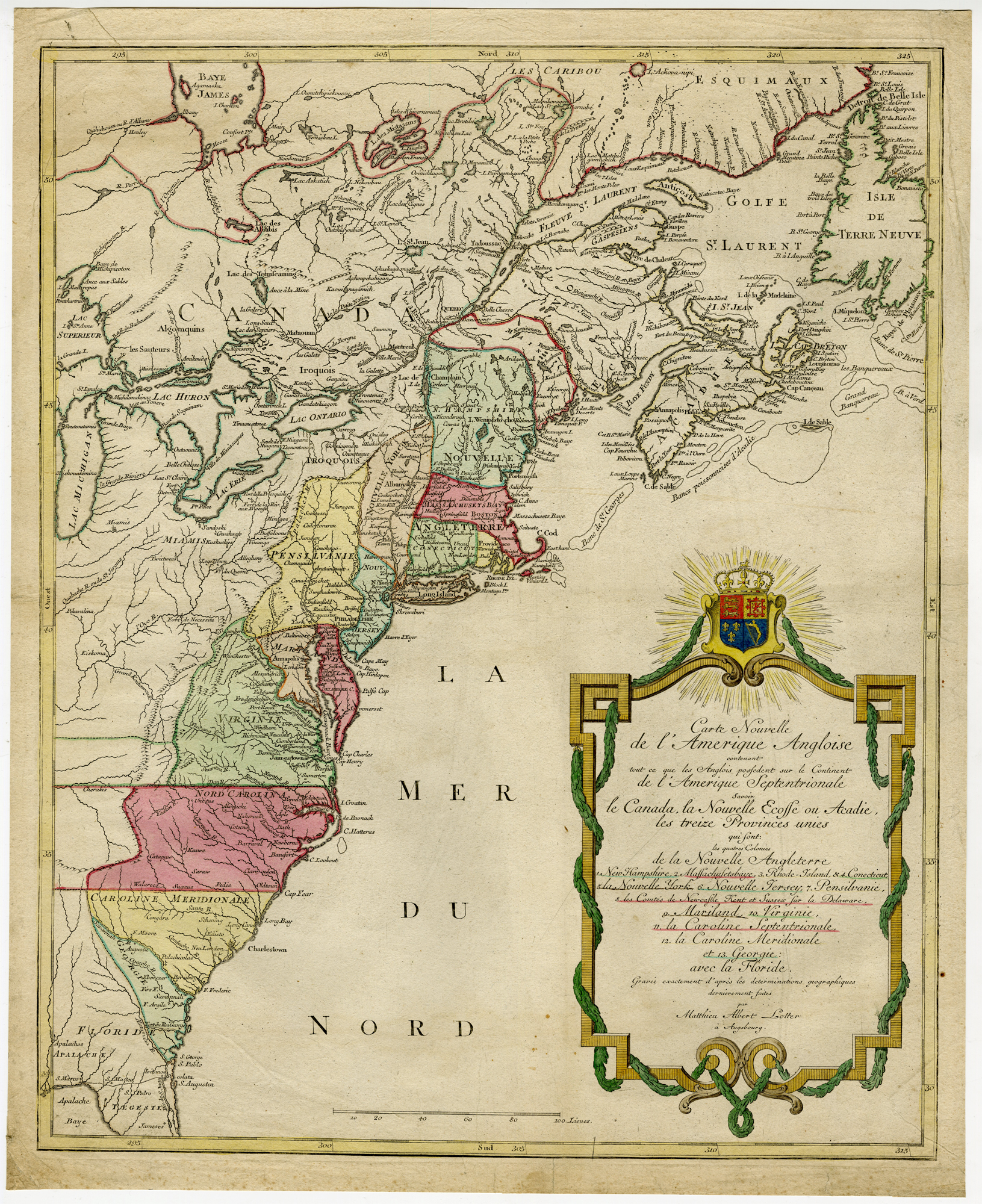
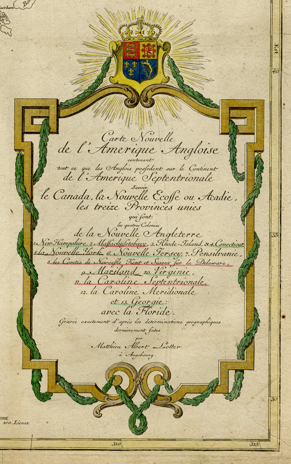
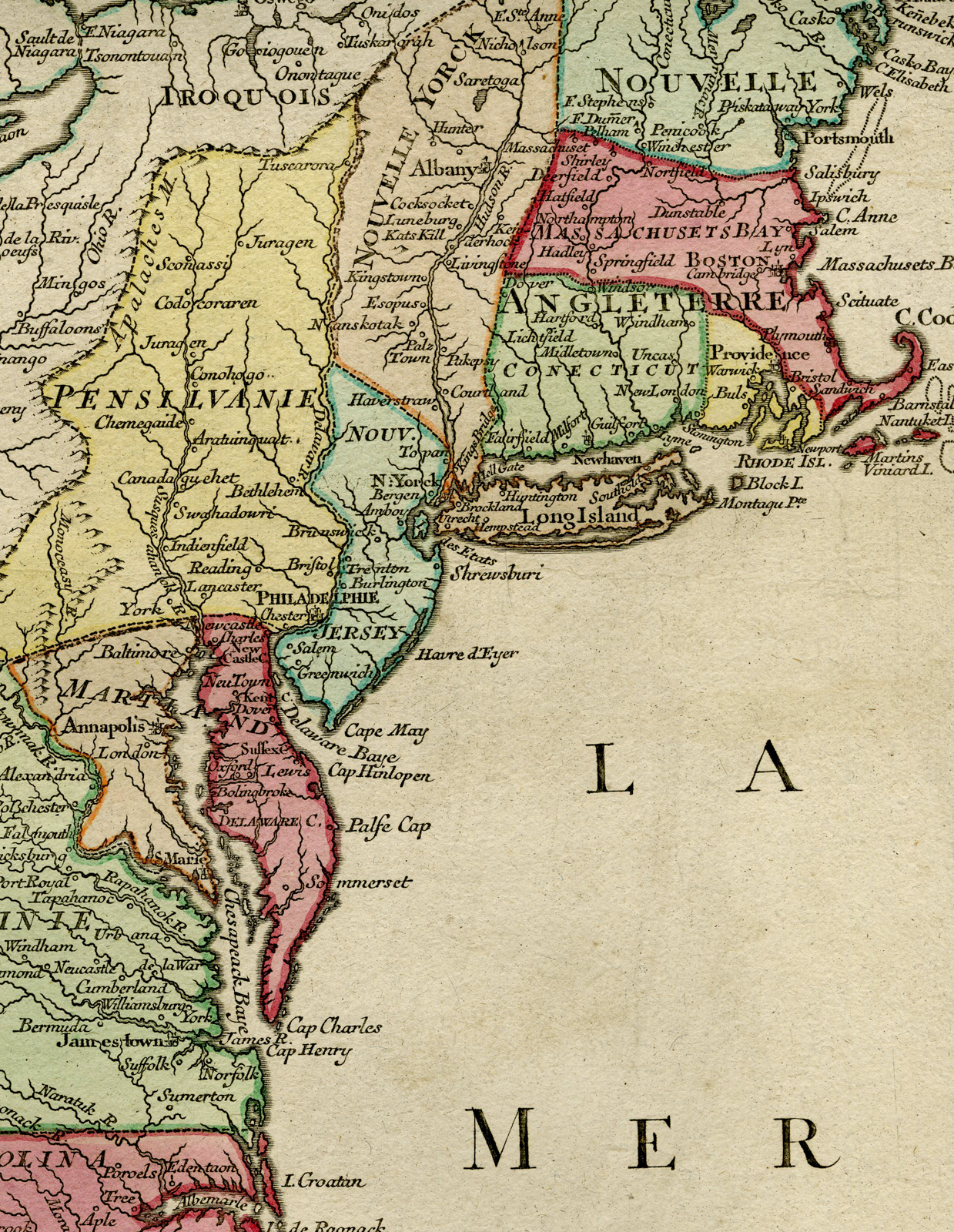
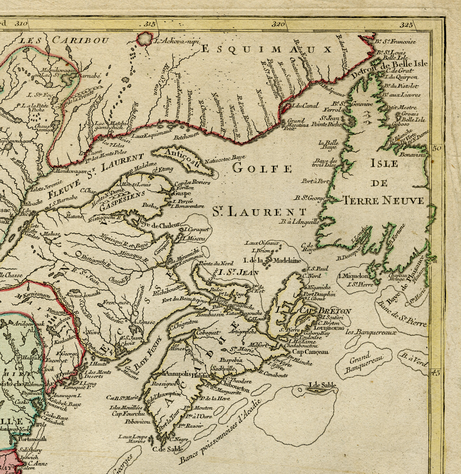
Carte Nouvelle de L’Amerique Angloise contenant tout ce que les Anglois possedent sur le Continent de L’Amerique Septentrionale savoir le Canada, la Nouvelle Ecosse ou Acadie, les treize Provinces unies … avec la Floride …
Augsburg: [1776].
Image: c. 49 x 60,5 cm.
Condition: Original colouring; old folding, mostly visible on rear; some small tears in paper edges, backed.
Published by Matthias Albrecht Lotter.
Ref: McCorkle, New England in Early Printed Maps 776.19; cf. Phillips, A List of Maps of A995merica, p. 3517; Sellers & Van Ee, Maps and Charts of North America and the West Indies 141.
PCO-Expo-245
![Landscape-Snaetburg-Maarssen [Anthonie BOSCH, 1801]](https://pictura-prints.com/wp-content/uploads/2019/03/pco_0780-324x257.jpg)
![CCCXLIII. Donaria pro Sacerdotibus. [Johann SCHEUCHZER after PINTZ, 1731]](https://pictura-prints.com/wp-content/uploads/2018/10/pcom-0754-e1540471943262-324x491.jpg)

Reviews
There are no reviews yet.