
Description
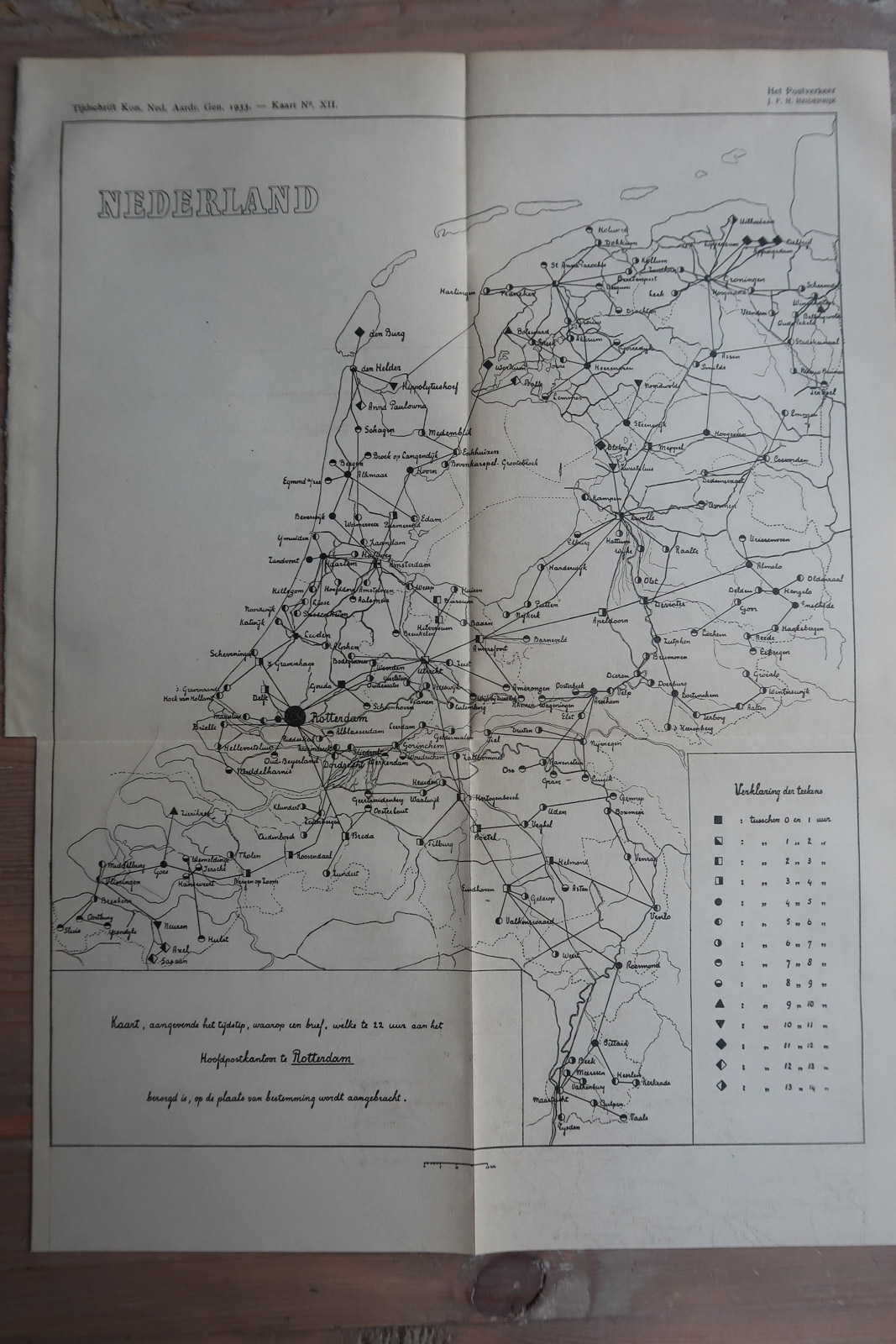
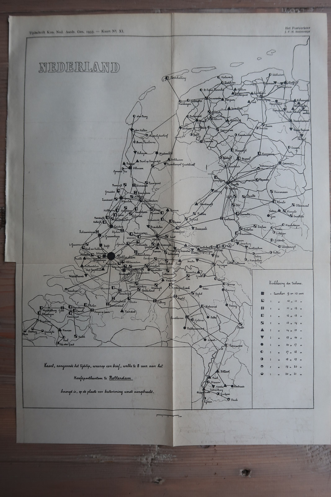
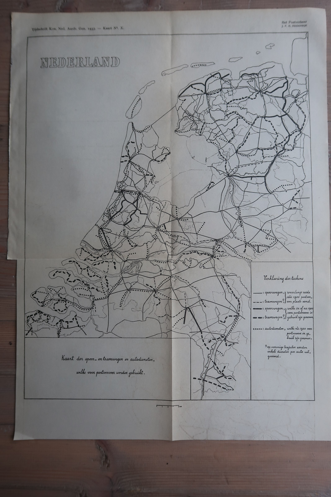
3 Maps related to the Dutch Postal service in 1933, illustrating the time it takes for letters to arrive posted from the Rotterdam postoffice. The third map illustrates the routes taken by the postal service by rail or car/truck.
Made by an anonymous engraver after J.F.H. Heidenrijk.
Medium: Lithograph on wove (vellin) paper.
Image size: 21.5 x 15 cm. (8.46 x 5.91 inch).
Condition: good, given age. Original folds as issued. General age-related toning and/or occasional minor defects from handling. Please study scan carefully.
POSTAL SERVICE DELIVERY-NETHERLANDS | PCO-B5-18
BACKGROUND INFORMATION
Source: ‘Tijdschrift van het Koninklijk Nederlandsch Aardrijkskundig Genootschap’, a periodical published from 1888-1966, initially published by C.F. Stemler and later by Brinkman/Beijers (from 1879) and Brill (from 1894). This item dates from 1933.


Reviews
There are no reviews yet.