


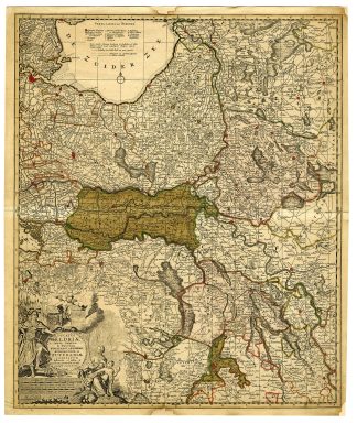
Description
Medium: Copper engraving, original hand-colored on hand-laid (verge) paper.
Sheet size: 51.3 x 61 cm (20.2 x 24.02 inch). Image size: 49 x 58.5 cm. (19.29 x 23.03 inch).
Condition: very good, given age. Light foxing, creasing and soiling. Original middle fold as issued. Paper loss at corners and top and bottom middle. Corner with tear, backed. Browning area reinforced with acid free paper on rear. General age-related toning and/or occasional minor defects from handling. Please study scan carefully.
GELDERLAND HISTORICAL MAP, ZUTPHEN OLD MAP, DUTCH CARTOGRAPHY, OTTENS MAP, 18TH-CENTURY NETHERLANDS MAP, ANTIQUE MAPS NETHERLANDS | MAPS-NETHERLANDS-OVERSIZE
BACKGROUND INFORMATION
Published in Amsterdam by Reinier and Joshua Ottens, based on earlier cartographic sources, circa 1720.
Reference: Hollstein vol.50 (Waterloo) p.15.
Biography engraver: Reinier and Joshua Ottens were Dutch publishers and cartographers active between 1726-1765 in Amsterdam. They reissued and modified existing plates from earlier mapmakers, producing detailed and highly decorative maps.

Reviews
There are no reviews yet.