
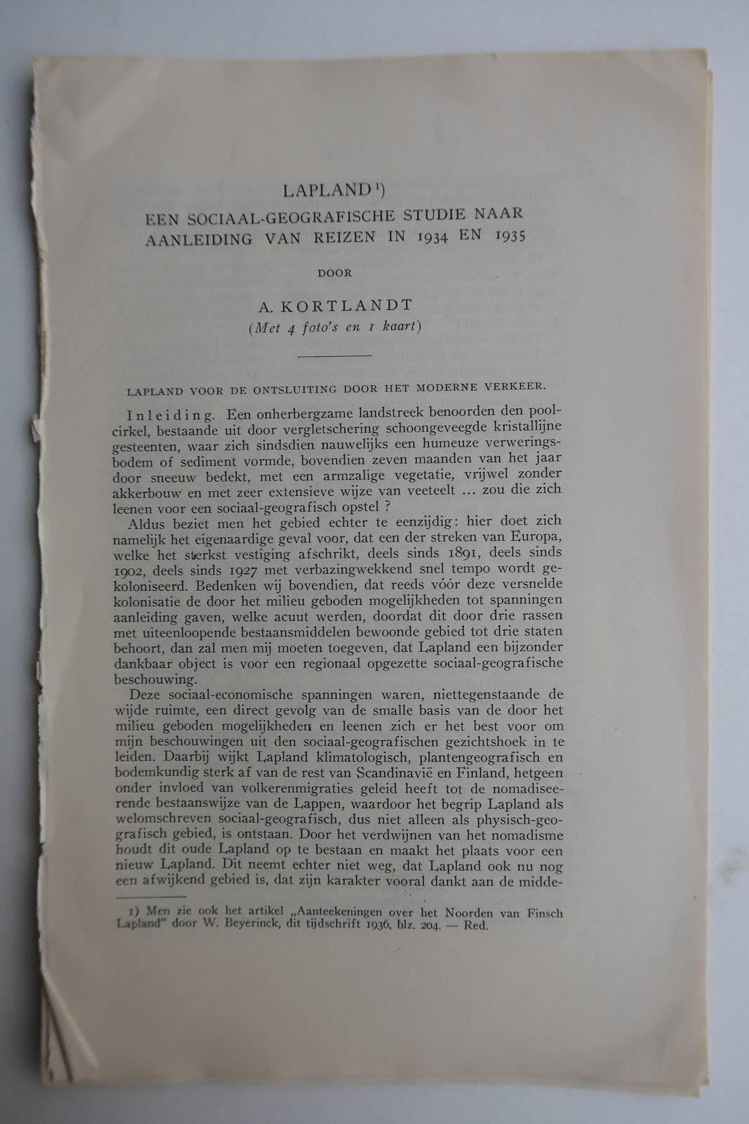
Description
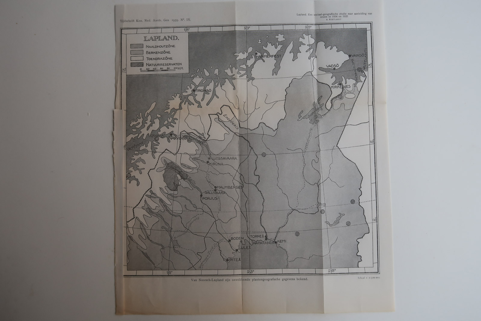
Map of Lapland and it’s division and natural areas. Made made as a result of socio-geographic voyayes made in 1934 and 1935.
Made by an anonymous engraver after A. Kortlandt.
Medium: Lithograph on wove (vellin) paper.
Image size: 28 x 20 cm. (11.02 x 7.87 inch).
Condition: good, given age. Original folds as issued. General age-related toning and/or occasional minor defects from handling. Please study scan carefully.
LAPLAND | PCO-B5-25
BACKGROUND INFORMATION
Source: ‘Tijdschrift van het Koninklijk Nederlandsch Aardrijkskundig Genootschap’, a periodical published from 1888-1966, initially published by C.F. Stemler and later by Brinkman/Beijers (from 1879) and Brill (from 1894). This item dates from 1939.


Reviews
There are no reviews yet.