
 Print
Print Description
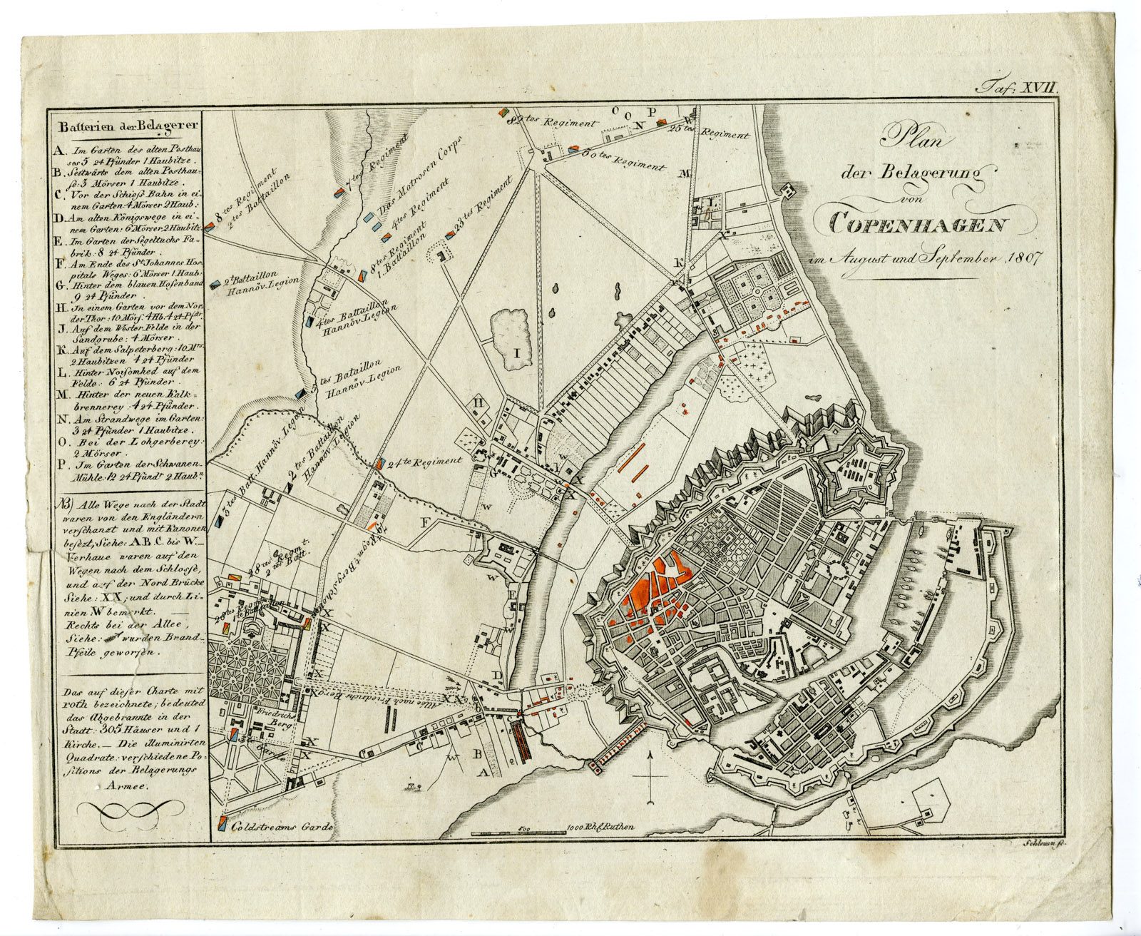
‘TAF. XVII. PLAN DER BELAGERUNG VON COPENHAGEN (..).’
Original antique military map showing a plan of the siege of Copenhagen in 1807.
Made by Schleuen after Freiherr August Daniel von Gross.
Engraving / etching on hand-laid (verge) paper.
Sheet size: 24 x 19.8 cm (9.45 x 7.8 inch). Image size: 22.3 x 16.4 cm. (8.78 x 6.46 inch).
Condition: fair, given age. A few spots / staining. Tear left in left paper edge, repaired. General age-related toning and/or occasional minor defects from handling. Please study scan carefully.
SIEGE OF COPENHAGEN
PCO-A18-45
BACKGROUND INFORMATION
From: ‘Historisch-Militarischer Atlas zu des Freyherrn A.G. von Gross …’. , published in Amsterdam and Schleuen, Kunst- und Industrie-Comptoir in c.1808. This Atlas with 18 maps covers battles in various parts of Europe from 1792-1808 and served as a military handbook.

Reviews
There are no reviews yet.