
 Print
Print Description
Engraving on wove paper. on paper.
Size in cm: The overall size is ca. 92.5 x 64 cm. The image size is ca. 87.6 x 58.6 cm. Size in inch: The overall size is ca. 36.4 x 25.2 inch. The image size is ca. 34.5 x 23.1 inch.
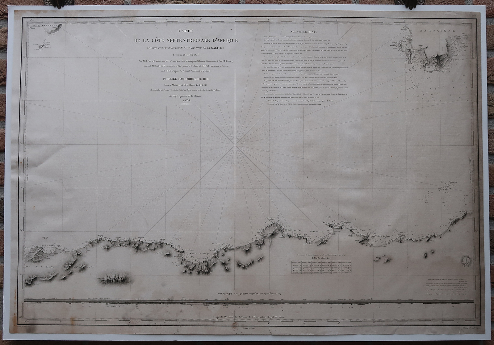
Antique map, titled: ”Carte de la Cote Septentrionale d”Afrique (partie comprise entre Alger et l”ile de la Galite) […].” – A map of the north African coast, from Algiers (Algeria) to Galita island. Also shows the southern tip of Sardinia and Mallorca. Depth soundings along the coast, and coastal towns. Some geographical features inland are shown, and a coastal profile. Published by the Depot de la Marine, 1836, based on the survey of Berard, et al. These type of charts are scarse as they were actually used at sea for navigation.Artists and Engravers: Made by ‘Chassant’ after ‘Depot de la Marine’. Depot des Cartes et Plans de la Marine (1720 – present), often called the Depot de Marine, was a French hydrographic mapping organization founded in 1720. Much like the U.S. Coast Survey, the British Admiralty, and the Spanish Deposito Hydrografico, the Depot was initiated as a storehouse and distribution center of existing nautical and marine charts. Eventually the Depot initiated its on mapping activities in an attempt to improve and expand upon existing material. Some of the well known hydrograhers / cartographers in the development of Depot were Jacques Nicholas Bellin and Rigobert Bonne.
Condition: Good, given age. Loosely attached to (modern cardstock) carrier, will ship w/o carrier. Right edge browned. Lower right corner faintly dampstained. A faint browned band over the middle of the sheet. Dampstained in the top and lower left margin corners. A tear in the lower margin. General age-related toning and/or occasional minor defects from handling. Please study scan carefully.
Keywords: ANTIQUE MAP-COAST-AFRICA-ALGIERS-ALGERIA-GALITA-DEPOT DE LA MARINE
(PCO) ZH-373

Reviews
There are no reviews yet.