
 Print
Print Description
Engraving on wove paper. on paper.
Size in cm: The overall size is ca. 68.4 x 100.6 cm. The image size is ca. 63.8 x 95.8 cm. Size in inch: The overall size is ca. 26.9 x 39.6 inch. The image size is ca. 25.1 x 37.7 inch.
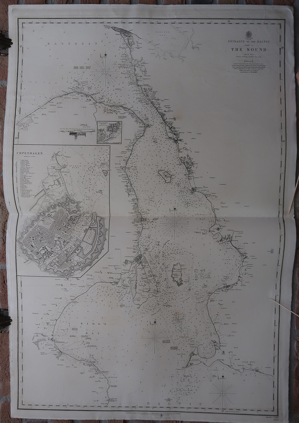
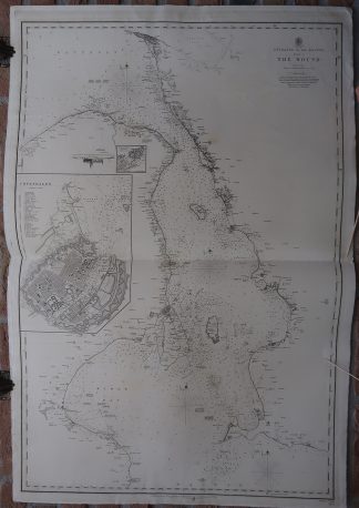
Antique map, titled: ”Entrance to the Baltic Sheet II. The Sound […].” – A marine map / coastal chart of the area near Copenhagen and Malmo. This shows the Koge Bugt, Oresund, Kattegat and Baltic Sea. With detailed depth soundings, and showing numerous islands, shoals, etc. An inset plan of Copenhagen and a small inset map of the harbour of Helsingor. Published by the Hydrographic Office of the Admiralty, 1852. Sold by J.D. Potter. Based on the Danish Survey map of 1846.Artists and Engravers: Made by ‘J. & C. Walker’ after an anonymous artist. John, Alexander and Charles Walker, known collectively as J & C Walker (active 1820-95), were engravers, draughtsmen and publishers working through the 19th century. The firm is best known for its work on the maps issued by the Society for the Diffusion of Useful Knowledge. However, they also engraved a large number of maps for the British Admiralty , as well as issuing several important maps of India and multiple issues of the Royal Atlas.
Condition: Very good, given age. Original middle fold, as issued. Offsetting where the map was folded on itself. A (closed) tear in the top right margin. A small tear in the lower margin. Some small creases in the margins/image edge. General age-related toning and/or occasional minor defects from handling. Please study scan carefully.
Keywords: ANTIQUE MAP-SEA CHART-DENMARK-COPENHAGEN-MALMO-SWEDEN-OFFICE ADMIRALITY
(PCO) GK-189


Reviews
There are no reviews yet.