

 Print
Print Description
Engraving on handlaid (verge type) paper. on paper.
Size in cm: The overall size is ca. 94.5 x 64.5 cm. The image size is ca. 87.5 x 57 cm. Size in inch: The overall size is ca. 37.2 x 25.4 inch. The image size is ca. 34.4 x 22.4 inch.
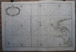
Antique map, titled: ‘No.27. Carte reduite des Passage de l’Iroise du Four et du Raz […]’ – (Detailed map of the Iroise, du Four and du Raz Passages.) Highly decorative sea chart / nautical map / maritime map of the passages off the western coast of Brittany, France. With: Isle d’Ouessan, Brest, Glenan islands. With a large decorative cartouche. Map orientation is north. From: L’Hydrographie Francoise Recueil des Cartes Generales et Particulieres qui ont ete Faites pour le Service des Vaisseaux du Roy. Par ordre des Ministres de la Marine depuis 1737. jusqu’en 1765. Par le S. Bellin Ingenieur de la Marine et du Depost des Cartes, Plans et Journaux de la Marine, Censeur Royal, de l’Academie de Marine et de la Societe Royale de Londres. This map is dated 1764 and has the engraved stamp of the Depot de la Marine at bottom left. Ref: Pastoureau. Original full size Atlas sheet. This sea chart includes extensive rhumb lines and a key describing the quality of the terrains along the coast. Islands and coastal settlements are labeled, including forts, ports, and villages. Highly detailed lines and soundings could help direct ships around the many small islands and narrow inlets.Artists and Engravers: Made by an anonymous engraver after ‘Jacques Nicolas Bellin’. Cartographer: Jacques-Nicolas Bellin (1703-1772) was a French hydrographer and geographer. He is considered the greatest 18 th. c. French hydrographer and for 50 years he was associated with the ‘Depot des cartes et Plans’ (Depot de la Marine) as the First hydrographer of the French Royal Navy. His maps were constantly updated with the latest information and their execution magnificent. Bellin’s major works are the ‘Neptune Francois …’, the ‘Petit Atlas Maritime …’ and the ‘Hydrographie Francoise …’ As a member of a French intellectual group called the ‘Philosophes’ and he contributed 994 articles to the ‘Encyclopedie’ by Diderot/d’Alembert. He also contributed to the ‘Histoire Generale des Voyages’ by Prevost.
Condition: Very good, given age. Original middle fold as issued. Light soiling. A few small tears in paper edges, not effecting image. Light damp staining. Some stains. Some creasing. General age-related toning and/or occasional minor defects from handling. Please study scan carefully.
Keywords: ANTIQUE MAP-BRITTANY-SEA CHART-27-PASSAGES-BREST-OUESSAN-FRANCE-BELLIN
(PCO) GK-045

Reviews
There are no reviews yet.