
 Print
Print Description
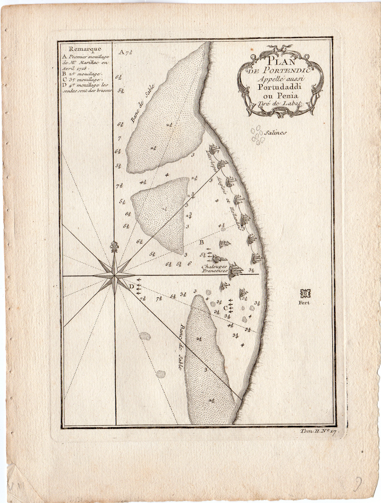
Original antique plan of Portendic called also Portu Daddy Penia, Mauritania. The anchorages in the area showing the Dutch and English separated from the French fleets.The anchorages are shown with depths in the bay.
Made by an anonymous engraver after Jacques Nicolas Bellin.
Medium: Engraving / etching on hand laid (verge) paper. Watermark: yes.
Sheet size: 20.6 x 26.8 cm (8.11 x 10.55 inch). Image size: 14.6 x 20.5 cm. (5.75 x 8.07 inch).
Condition: good, given age. Light foxing. Left edge with tiny holes from binding. General age-related toning and/or occasional minor defects from handling. Please study scan carefully.
AFRICA-PORTENDIC-MAURITIANIA-ANCHORAGE-DUTCH AND ENGLISH FLEET | RB-A9-08
BACKGROUND INFORMATION
Published in Prevosts 15 volumes of Histoire Generale des Voyages written by Prevost & other authors between 1746-1790. The work was published by Chez Didot in Paris in 1746. The plates and maps were by Cochin fils, Tardieu, B. L. Prevost and others.
Biography artist: Jacques Nicolas Bellin (1703-1772), was a French hydrographer and geographer. He is considered the greatest 18 th. c. French hydrographer and for 50 years he was associated with the ‘Depot des cartes et Plans’ (Depot de la Marine) as the First hydrographer of the French Royal Navy. His maps were constantly updated with the latest information and their execution magnificent. Bellin’s major works are the ‘Neptune Francois …’, the ‘Petit Atlas Maritime …’ and the ‘Hydrographie Francoise …’ As a member of a French intellectual group called the ‘Philosophes’ and he contributed 994 articles to the ‘Encyclopedie’ by Diderot/d’Alembert. He also contributed to the ‘Histoire Generale des Voyages’ by Prevost.


Reviews
There are no reviews yet.