
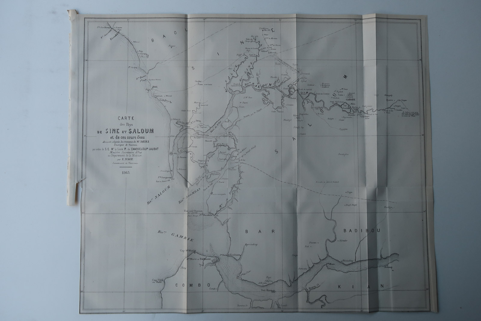
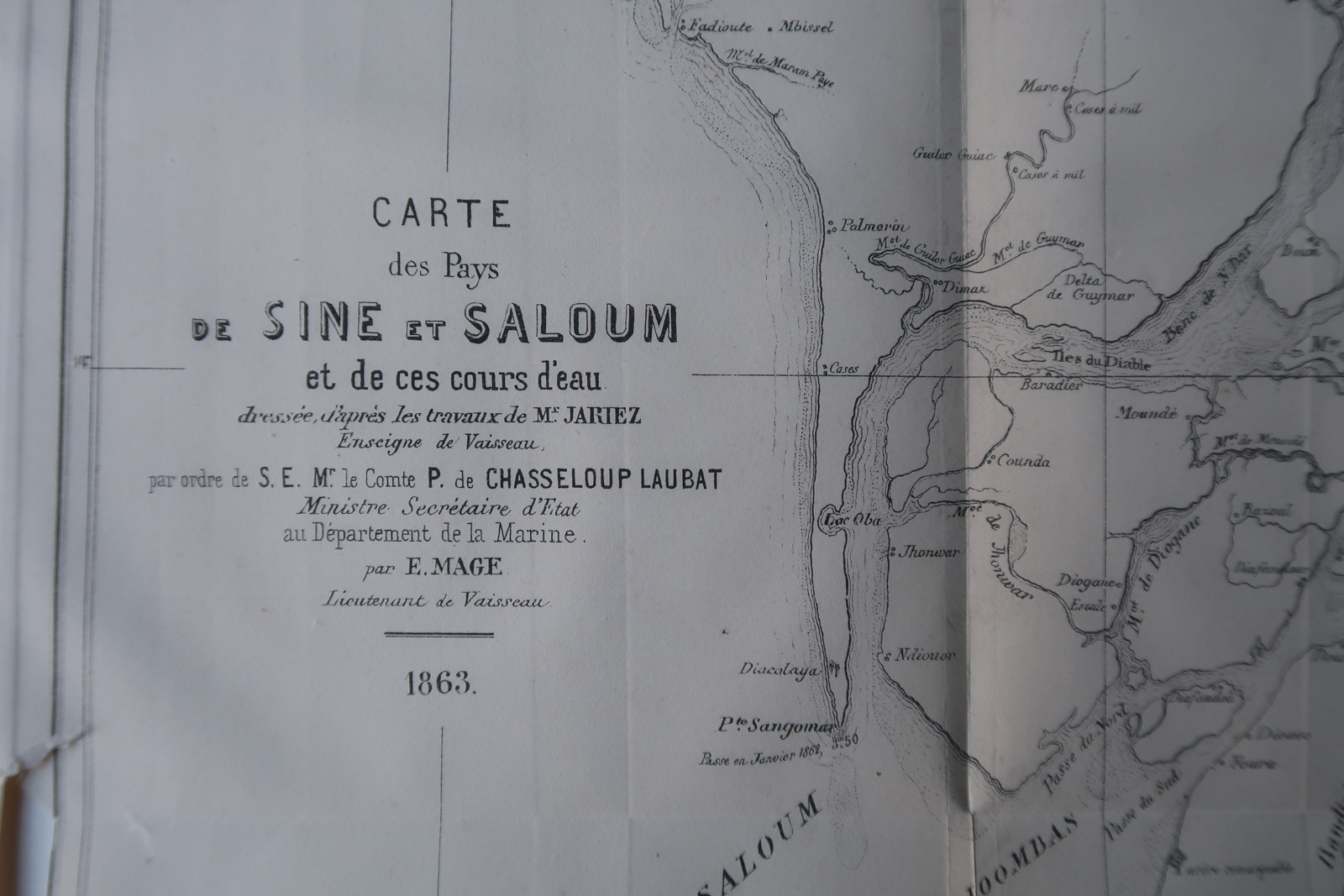
Description
French Navy map from 1863 of the Sine and Saloum rivers in Senegal, western Africa.
Made by Anonymous after Revue Maritime.
Medium: Engraving on wove (vellin) paper.
Sheet size: 43 x 35 cm (16.93 x 13.78 inch).
Condition: very good, given age. Original folds as issued. Minor tear left edge, will be repaired. General age-related toning and/or occasional minor defects from handling. Please study scan carefully.
SENEGAL-SINE-SALOUM RIVER-FRENCH NAVY | PCO-B5-13
BACKGROUND INFORMATION
From ‘Revue Martime et Coloniale’, a periodical published in Paris from 1861-1896 by the French ‘Ministere de la Marine et des Colonies’. This item was published in 1869.


Reviews
There are no reviews yet.