
Description
Etching / engraving on hand laid paper. on paper.
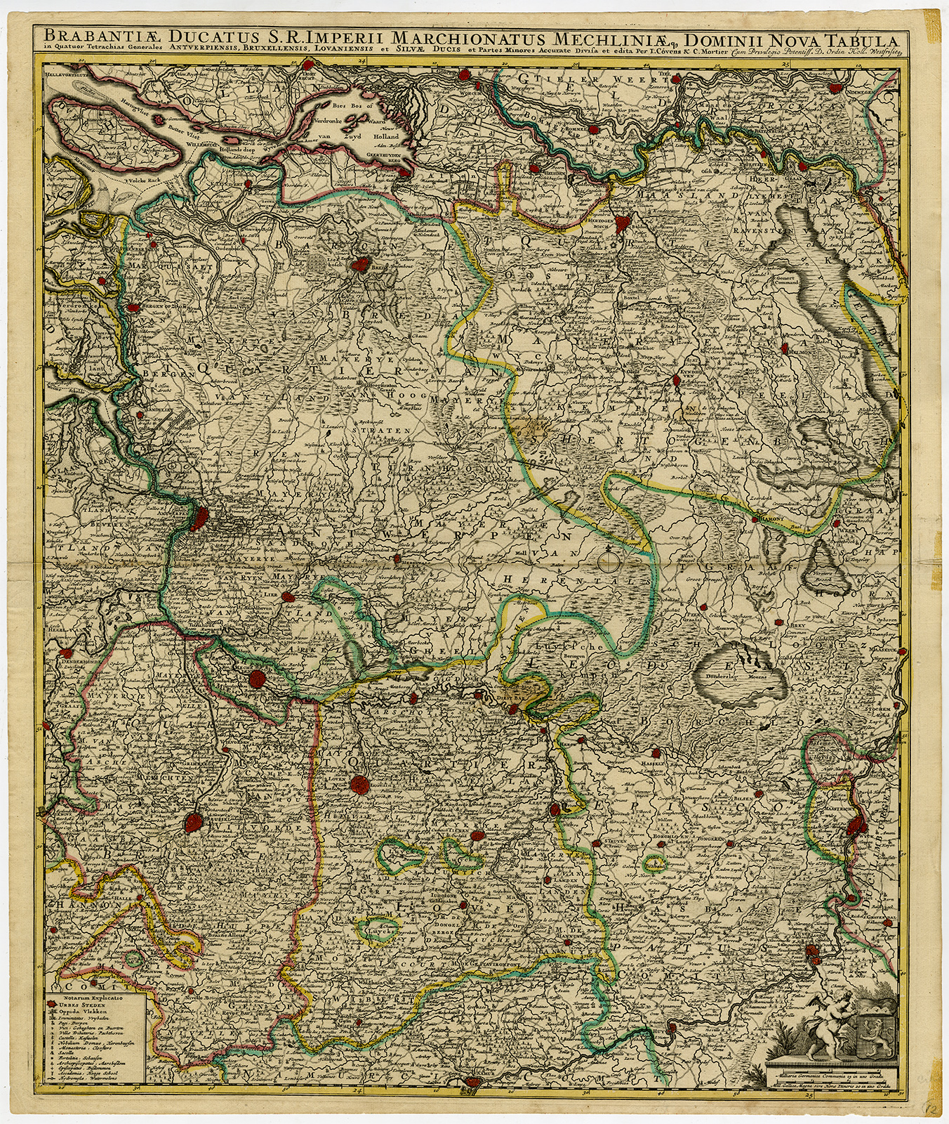
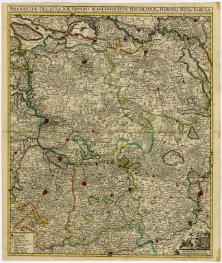
Size in cm: The overall size is ca. 53.4 x 62.8 cm. The image size is ca. 50.2 x 60.9 cm. Size in inch: The overall size is ca. 21 x 24.7 inch. The image size is ca. 19.8 x 24 inch.
Antique print, titled: ‘Brabantiae ducatus S.R. Imperii Marchionatus Mechliniae dominii nova tabula in quatuor tetrachias generales Antverpiensis, Bruxellensis, Lovaniensis et Silvae Ducis et partes monores accurate divisa et edita per I. Covens & C. Mortier.’ – Large overview map of the Province of Brabant, part of present day Belgium and The Netherlands. Originally published by Frederick de Wit.Artists and Engravers: Made by an anonymous engraver after ‘Covens & Mortier (publisher)’. Pieter and David Mortier were booksellers in Paris and have published a wide range of geographical works. After Pieter’s death, his widow continued the business until their son Cornelius took over. Cornelius started a partnership with his brother-in-law Johannes Covens (1697-1774) and established the famous publishing house “Covens and Mortier” in Amsterdam. They have re-issued Atlases of Sanson, de l’Isle, Visscher and de Wit.
Condition: Very good, given age. Original middle fold as issued. Small tears in margin of fold, backed by contemporary paper. General age-related toning and/or occasional minor defects from handling. Please study scan carefully.
Keywords: ANTIQUE PRINT-BRABANTIAE DUCATUS-NETHERLANDS-BELGIUM-COVENS & MORTIER
XXX-B2-42


Reviews
There are no reviews yet.