
Description
Outline coloured engraving on wove paper. on paper.
Size in cm: The overall size is ca. 47.5 x 34 cm. The image size is ca. 39.5 x 29 cm. Size in inch: The overall size is ca. 18.7 x 13.4 inch. The image size is ca. 15.6 x 11.4 inch.
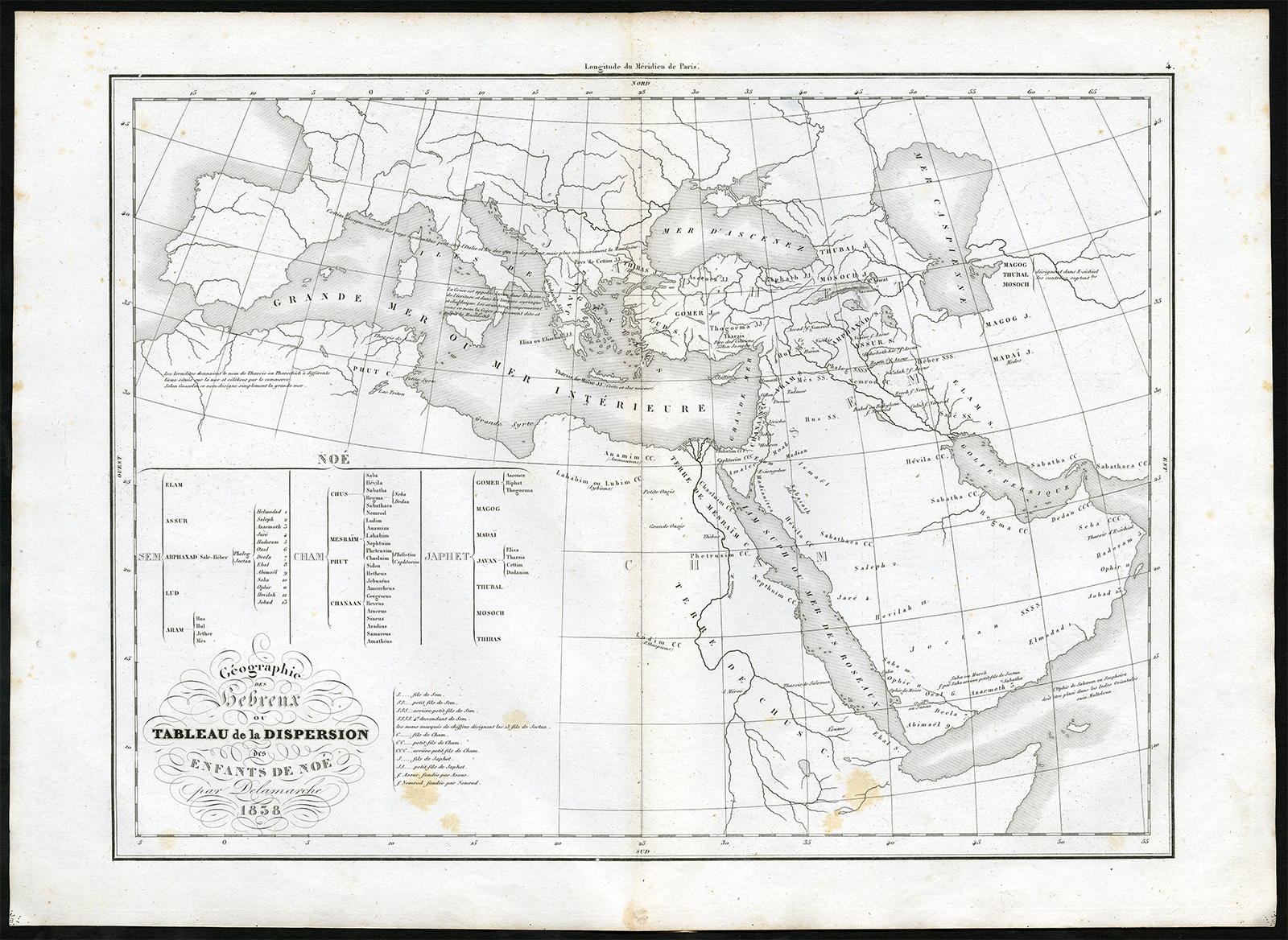
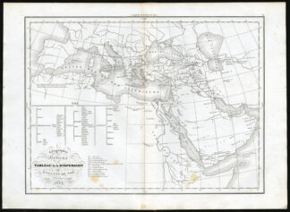
Antique print, titled: ‘Carte du des Hebreux ou Tableau de la Dispersion des Enfants de Noe.’ – A map of the Hebrew people and the dispersion of the children of Noah. Letter combinations after the names denote lineage. “Atlas de la Geographie Ancienne, du Moyen-age et Moderne”, Felix Delamarche. Paris: 1840.Artists and Engravers: Made by an anonymous engraver after ‘Felix Delamarche’. Charles Francois Delamarche (1740-1817) founded the important and prolific Paris based Maison Delamarche map publishing firm in the late 18th century. A lawyer by trade Delamarche entered the map business with the acquisition from Jean-Baptiste Fortin of Robert de Vaugondy’s map plates and copyrights and later adds many plates from other sources as well. Charles Delamarche eventually passed control of the firm to his son Felix Delamarche (18th c. – 1st half 19th c.) and geographer Charles Dien (1809-1870). It was later passed on to Alexandre Delamarche, who revised and reissued several Delamarche publications in the mid-19th century. The firm continued to publish maps and globes until the middle part of the 19th century.
Condition: Very good, given age. Original middle fold, as issued. Some faint scattered foxing. General age-related toning and/or occasional minor defects from handling. Please study scan carefully.
Keywords: ANTIQUE PRINT-ANCIENT-DISPERSION-LINEAGE NOAH-DELAMARCHE
(PCO) A301-34


Reviews
There are no reviews yet.