
Description
Copperplate engravings / etchings on a verge type of hand laid paper. Outline hand-colour. on paper.
Size in cm: The overall size is ca. 43.5 x 53.1 cm. The image size is ca. 40.9 x 48.6 cm. Size in inch: The overall size is ca. 17.1 x 20.9 inch. The image size is ca. 16.1 x 19.1 inch.
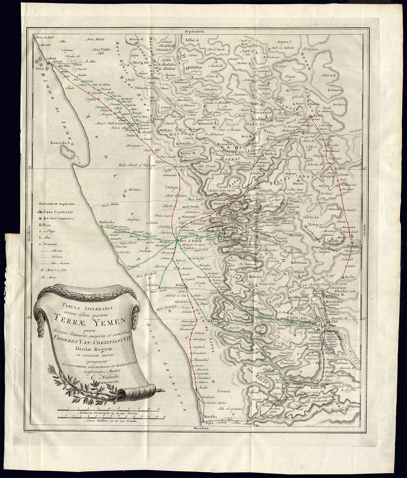
Plate Tab LXXI: ‘Tabula Itineraria sistens illam partem Terrae Yemen …’ (Map of Yemen). This original antique print originates from ‘Reize naar Arabie en andere omliggende landen, van Carsten Niebuhr uit het Hoogduitsch vertaald.’, published in Amsterdam by S.J. Baalde and Utrecht by J. van Schoonhoven & comp., 1776. (Translation: Voyage to Arabia and surrounding countries by Carsten Niebuhr, translated from German.) This is the Dutch ed. translated and enlarged from ‘Reisebeschreibung von Arabien und anderen umliegenden L�ndern (1774-1778). Carsten Niebuhr (1733-1815) travelled extensively in Arabia, Persia, Palestine and Asia Minor, and became by his descriptions and maps and the richness of his observations the pioneer of a more profound knowledge of the Orient. Ref: Tiele 795 and 796. Howgego N24. Gay 3589. cf. Graesse IV, 674/ Cox I, 237. Aboussouan 682-683 and Lipperheide Lc6.Artists and Engravers: This plate by T. Koning.
Condition: Excellent. General age-related toning. Occasional minimal staining. Original folds. Please study scan carefully.
Keywords: ANTIQUE MAP-YEMEN-ARABIAN PENINSULA-NIEBUHR-KONING
(PCO) A253-03

Reviews
There are no reviews yet.