
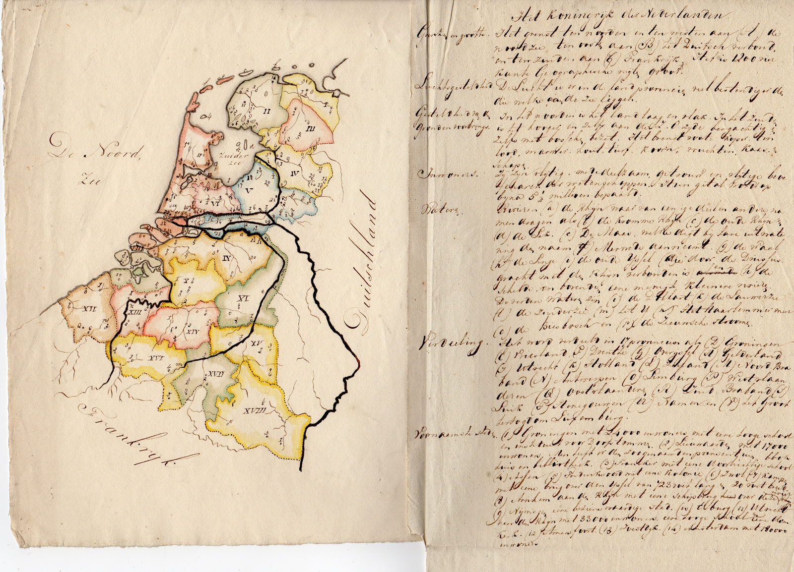
Description
Subject: Antique print, titled: ”Het Koninkrijk der Nederlanden.” – Manuscript map of the Kingdom of The Netherlands in c. 1828 including present dat The Netherlands, Belgium and Luxembourg.
Condition: Very good, given age. Key page is attached to map. Some creasing an folds from holding and storage. General age-related toning and/or occasional minor defects from handling. Please study scan carefully.
Medium: Pen and ink drawing on wove paper.
Size (in cm): The overall size is ca. 40.5 x 28.5 cm. The image size is ca. 18 x 21.5 cm.
Size (in inch): The overall size is ca. 15.9 x 11.2 inch. The image size is ca. 7.1 x 8.5 inch.
Part Number: 65498
Location: PCO-B1-10
Description: This map was part of a small collection of manuscript maps. One map was signed J. Hool and dated 1832. Style of writing match this map. Since Belgium became independent in 1830, this map should be dated prior to that date.
Artists and Engravers: Made by ‘J. Hool’ after an anonymous artist. We have not been able to find information on the maker of this map.
![[Willem VAN LEUSDEN] Untitled mountain landscape](https://pictura-prints.com/wp-content/uploads/2018/07/pco_1161-324x456.jpg)
![CCCCLXIX. Oleum et Farina Sareptanae. [Johann SCHEUCHZER after TYROFF, 1731]](https://pictura-prints.com/wp-content/uploads/2018/10/pcom-0719-e1540471474832-324x485.jpg)
![LANDSCAPE-LARGE STRUCTURE-TOWERS-GATE 'Untitled' [ANONYMOUS, ca. 1940]](https://pictura-prints.com/wp-content/uploads/2018/07/pco_1513-324x342.jpg)
![VILLAGE VIEW-CHURCH-FENCED FIELD 'Untitled' [ANONYMOUS, ca. 1940]](https://pictura-prints.com/wp-content/uploads/2018/07/pco_1518-324x423.jpg)


Reviews
There are no reviews yet.